

This couple who live off the grid in a floating cabin want to take us on a trip “up the lake”
My husband Wayne and I discovered Powell River while on a summer holiday in 2000. On a return trip in 2001 we discovered Powell Lake and its unique float cabins. The one we purchased that year has become our home in all seasons. Come along with us on a trip up the lake and see why it continues to excite and inspire us every day.
Water from rivers and glaciers in the Coastal Range flows through Powell Lake down to the short (only 500 metre) Powell River near the town that bears its name and into the Strait of Georgia.
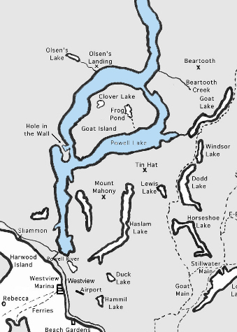
Powell Lake Region Map
Powell Lake is 51 kilometres long, has 480 kilometres of shoreline, and is 360 metres deep in the lower basin.
Hop aboard. The boat’s ready to leave the public dock next to the Shinglemill Pub and Bistro. This is where Wayne and I sat on the deck having dinner all those years ago wondering where all the boats were going. Many Powell Riverites know, but if you’re new to town or planning a visit in the future, here’s a sneak preview.
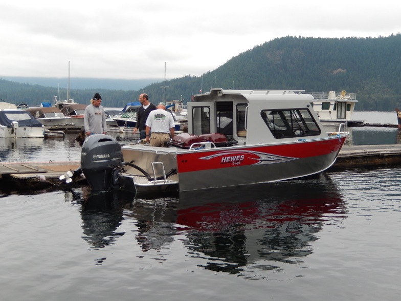
A boat at the Shinglemill dock getting ready to go up the lake
Powell Lake was created when glaciers scoured out its deep fjord. After the heavy ice and snow retreated 10,000 years ago, the land rose and seawater was trapped. Fresh water on top did not mix with the heavier saltwater below. After hearing about research in the 1960s, Wayne and I did some deep-water sampling of our own. Then we met the current UBC team and continue to follow their studies.
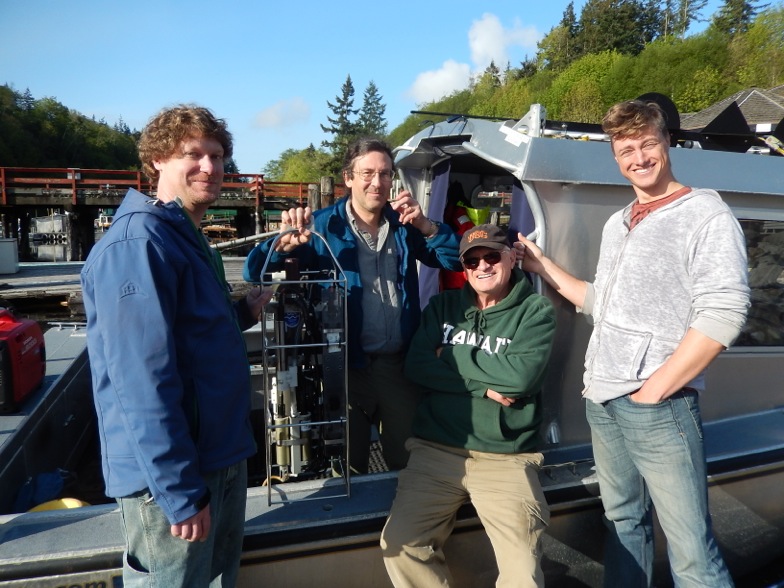
Wayne with the UBC Oceanographic Team
Heading up the lake, the first things you’ll notice are float cabins dotting the shore. The farther you go, the more you’ll see. There are about 250 cabins on the lake. A moratorium in 1998 limits expansion and keeps our lake pristine. Here’s a picture of the one that caught our eye and lured us to move to Powell River.
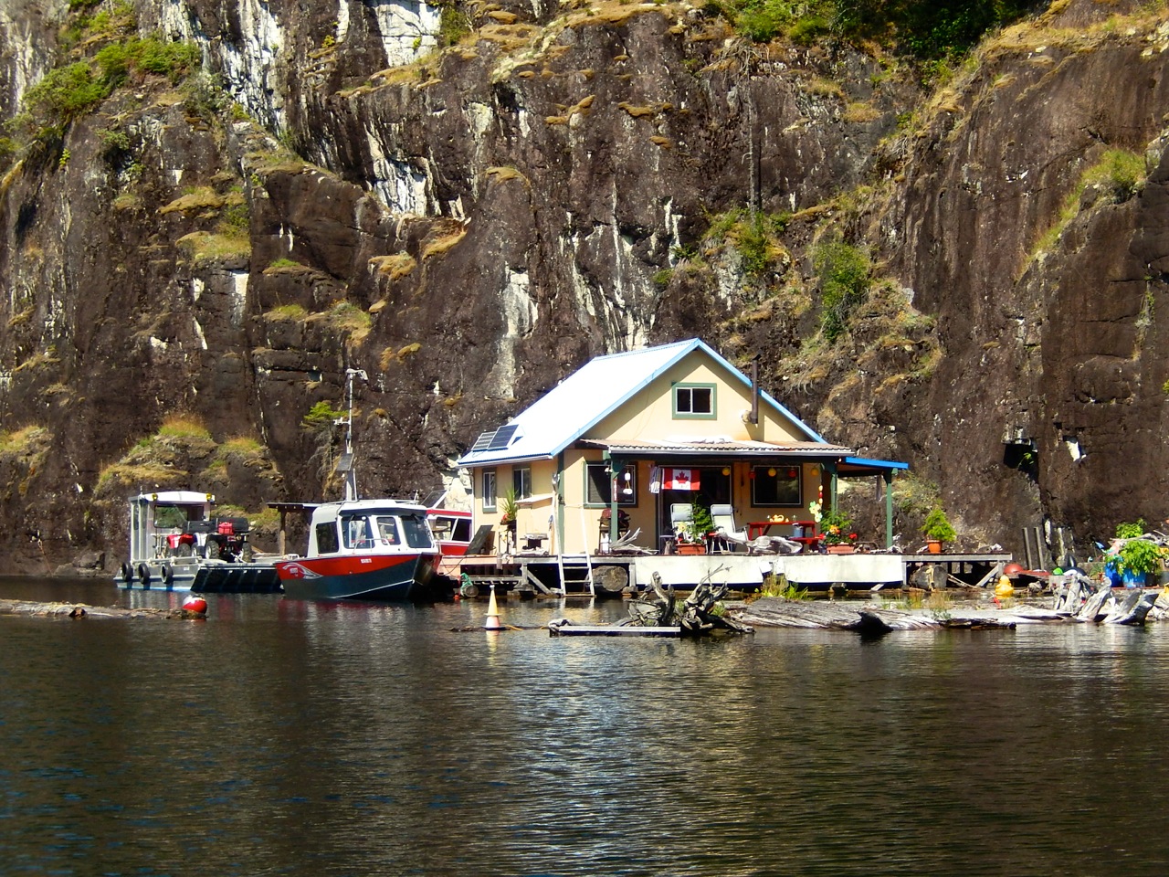
Our Float Cabin
As we proceed to the end of the lower lake, there’s tiny Cassiar Island in the distance. We’ll tuck in behind and get some protection from what our friend John calls the North Sea, the wide stretch that can get some big waves on a stormy day.
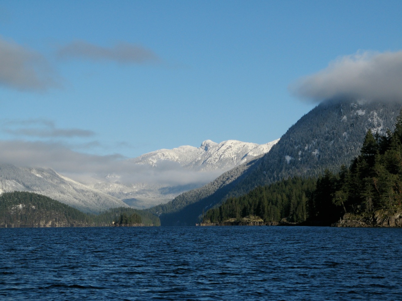
Cassiar Island with the mountains in the background
In the middle of Powell Lake is massive Goat Island. It rises abruptly in the south, but the north end has the highest granite bluff, home to mountain goats. We pass through First Narrows between the south end of Goat Island and the mainland shore. Here’s where Wayne and I like to fish for trout. Just past First Narrows is the entrance to Hole in the Wall, and our float cabin home.
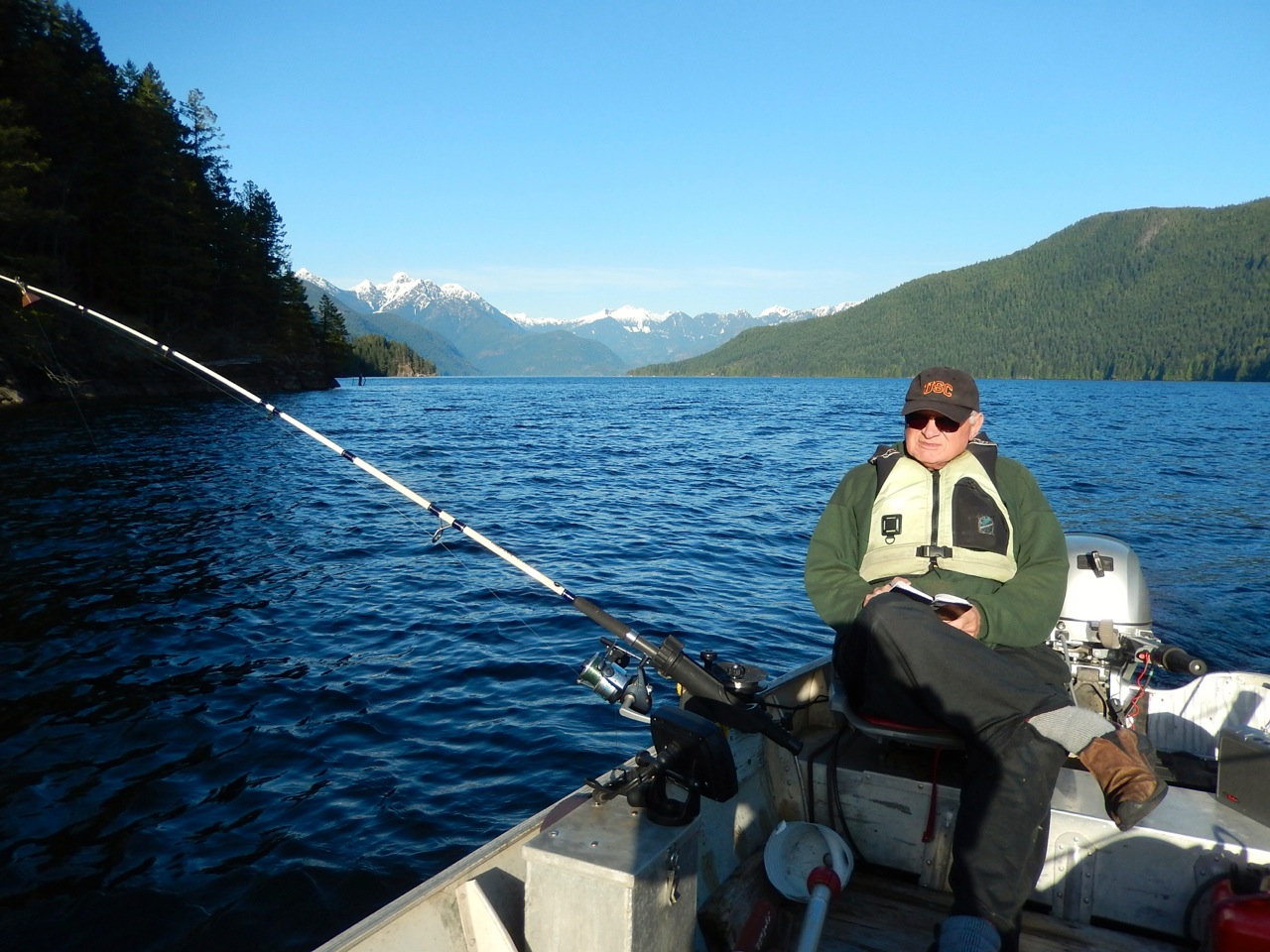
Wayne fishing in First Narrows
From First Narrows, we continue up the west side of Goat Island towards the head of the lake. On the way, keep an eye out for Elvis, crooning away on a point named in his honour.
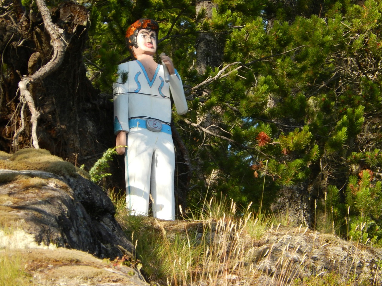
Elvis Point
As we approach the northern end of Goat Island, we’ll head over to the mainland side and stop at the Olsen’s Landing logging dock for a stretch break. From here you can see Second Narrows at the North end of Goat Island and the high country beyond.
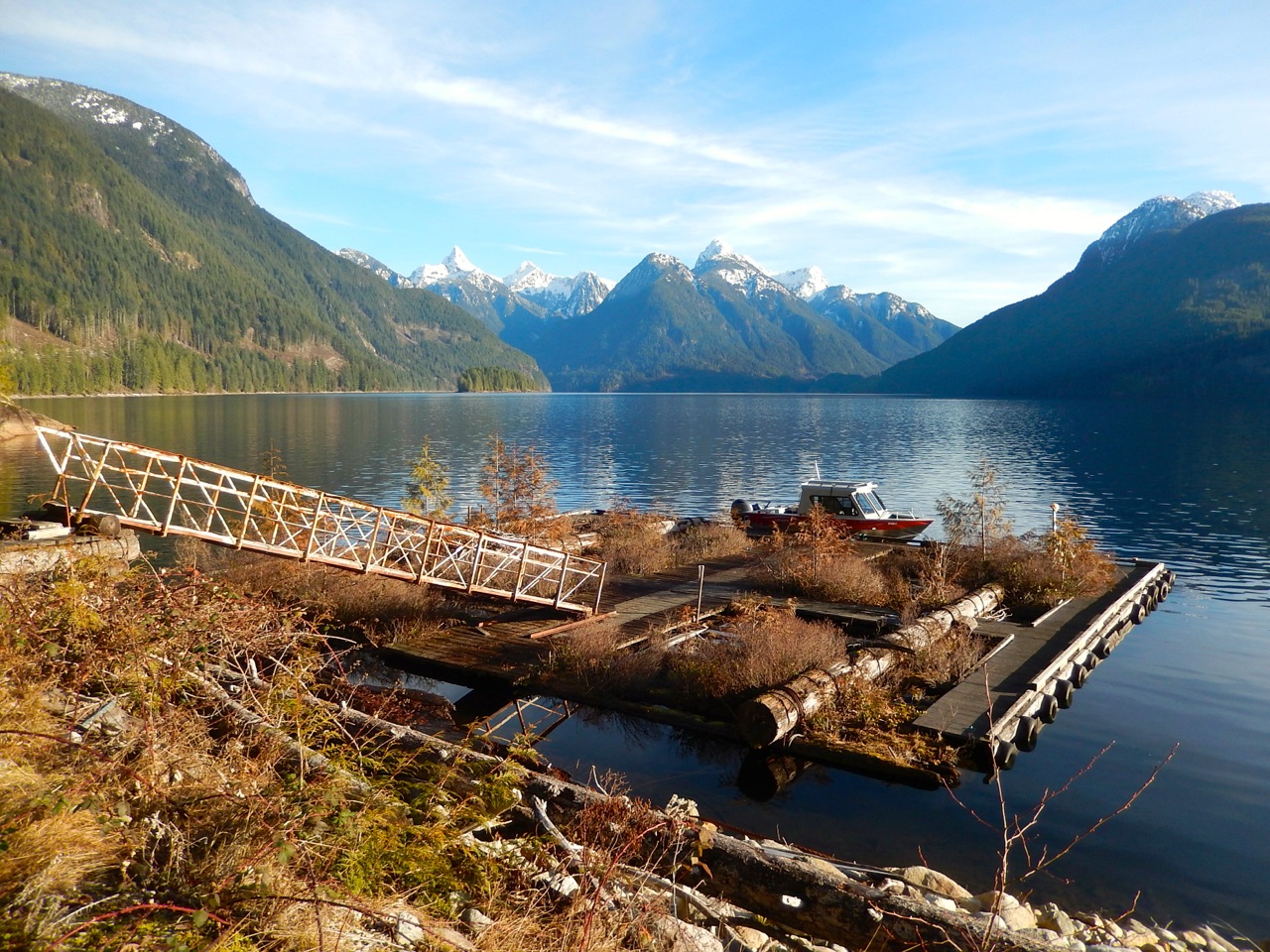
Olsen’s Landing
We get back in the boat and head straight for the snow capped peaks ahead. Bearing to the left we’re almost to the head of Powell Lake. Come in the spring for spectacular waterfalls. This is an active portion of the lake, so we’ll keep our eyes open for tugs moving equipment and logs.
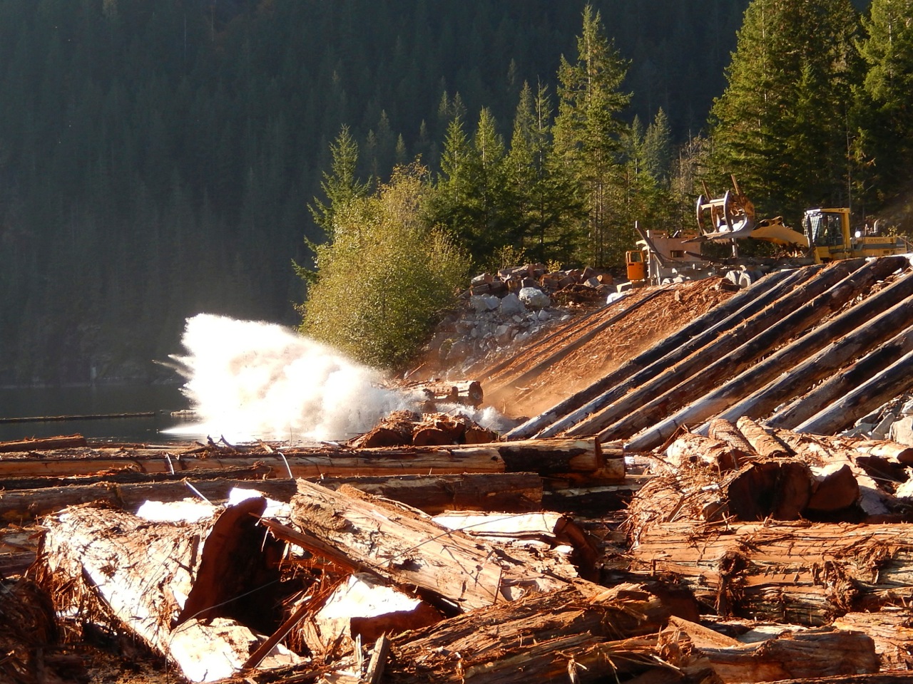
Dumping logs at the head of the Lake
We might even get to see trucks dumping their loads into the waiting booms, ready for the long tow to the south end of the lake.
And from the head of Powell Lake, water that will ultimately flow through the Powell River begins its long journey to the sea.
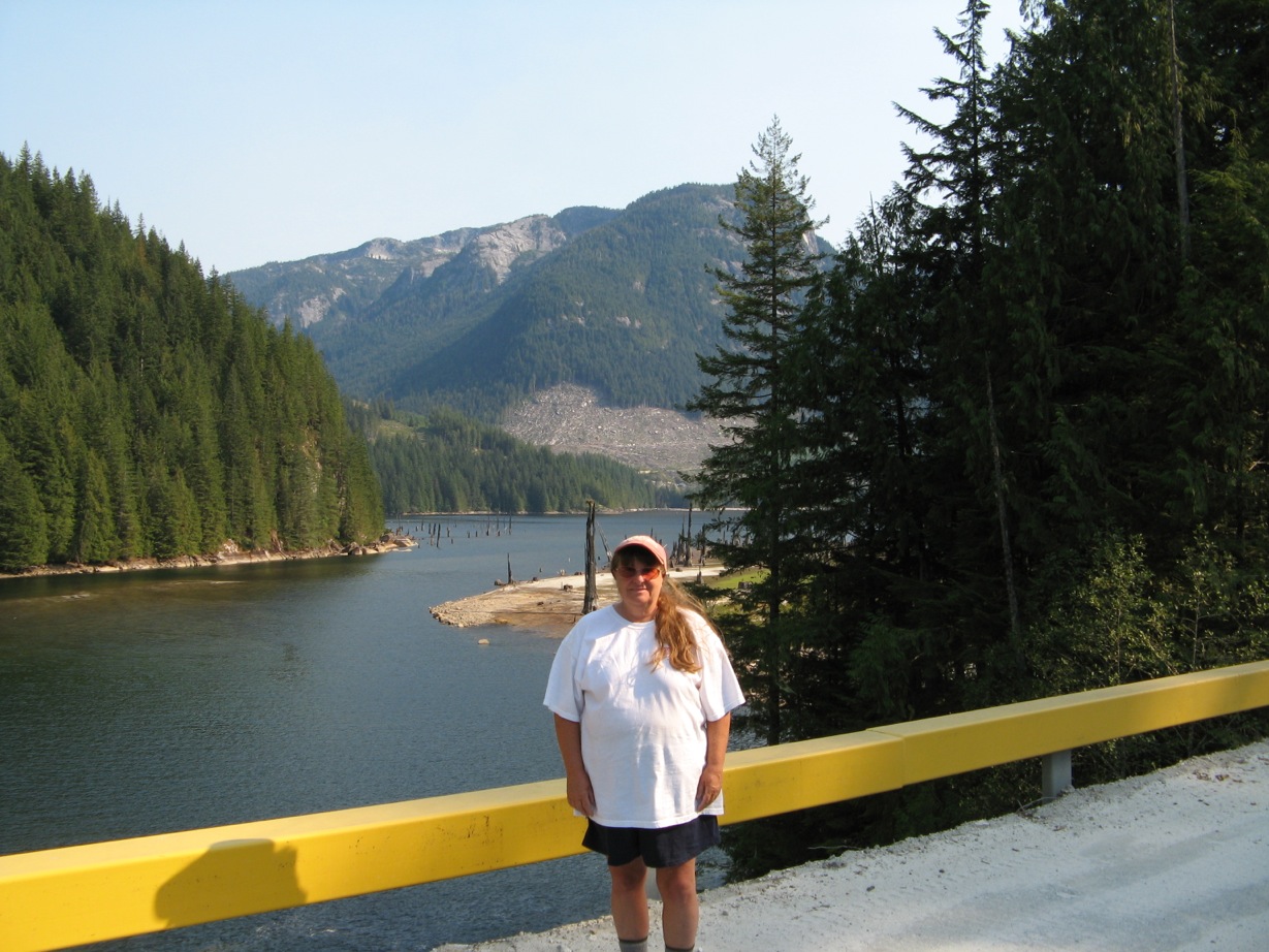
Me, at the head of the lake
The best way to experience Powell Lake is by boat, but you can also access it by car, off-road vehicle, floatplane, canoe, kayak, and on foot. The southern shore is accessible by car at Mowat Bay in Cranberry, Powell Lake Marina, and the Haywire Bay Regional Campground. The Sunshine Coast Trail skirts portions of the lower lake, the Powell River Forest Canoe Route passes through Powell Lake, and several logging roads give off-road vehicles remote access.
Here are some resources about Powell Lake:
- Tourism Powell River
- Powell River Museum
- Haywire Bay Regional Campground
- Shinglemill Pub, Bistro and Marina
- Up the Lake, Farther Up the Lake, and Off the Grid
Up the Lake, Wayne’s first book in the Coastal BC Stories series, is available free for most ebook readers. It follows our discovery of Powell River, the first years of float cabin living, and regional exploration. More information can be found at our website www.PowellRiverbooks.com and my blog about Powell Lake float cabin living at http://PowellRiverBooks.blogspot.com.
Thanks for coming along for the ride. Hope to see you up the lake.
— Margy

Margy Lutz
Latest posts by Margy Lutz (see all)
- Learn a little bit about the logging industry in Powell River - November 18, 2016
- Quadding on “The Rock” - July 19, 2016
- Learning to sail on Powell Lake - June 28, 2016